 ar
ar bg
bg hr
hr cs
cs da
da nl
nl fi
fi fr
fr de
de el
el hi
hi it
it ko
ko no
no pl
pl pt
pt ro
ro ru
ru es
es sv
sv tl
tl iw
iw id
id lv
lv lt
lt sr
sr sk
sk sl
sl uk
uk vi
vi et
et hu
hu th
th tr
tr fa
fa ms
ms hy
hy ka
ka ur
ur bn
bn mn
mn ta
ta kk
kk uz
uz ku
ku
Inclinometer
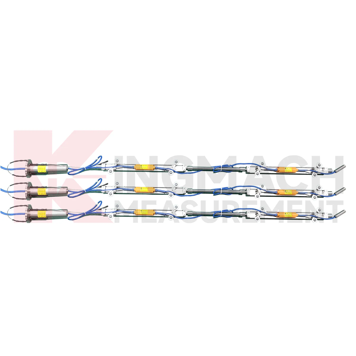
The JMQJ-7915ATS vertical in-place inclinometer system gives Kingmach Inclinometer a multi-point downhole monitoring method. The system consists of a multi-point tandem inclinometer string and an orifice acquisition module. Multiple MEMS inclination sensors are electrically connected through a single cable inside the borehole, while universal joints and connecting rods arrange measuring points according to design spacing. The system can divide sensors into up to four independent communication groups, uses automatic temperature compensation, and includes electronic identifiers for automatic recognition and intelligent calculation. Published specifications include dual-axis +/-90 degrees tilt range, 0.001 degree resolution, 0.01 degree accuracy, DC 9V to 24V operating voltage, power consumption below 0.2W, single-wire uplink communication at 1200 bps, -30 degrees Celsius to +70 degrees Celsius operating temperature, 0.35 m guide wheel spacing, about 0.8 kg weight, and IP68 protection.
Application of Inclinometer
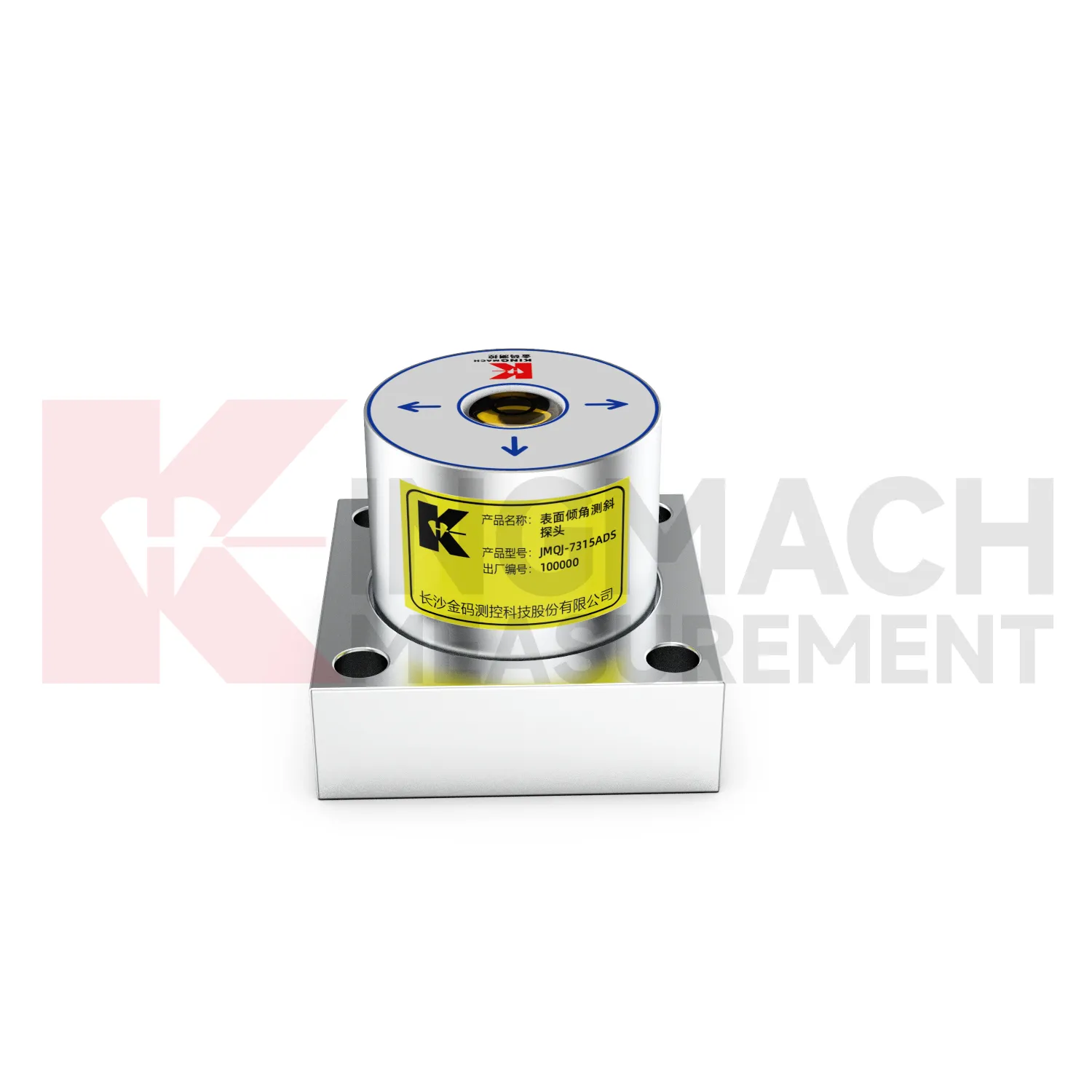
Foundation pit projects use Inclinometer to monitor retaining wall rotation, support system response, adjacent building tilt, and deep ground movement during excavation. JMQJ-7315ADS can track angular change on exposed structures, while JMQJ-7915ATS can monitor multi-depth deformation inside a borehole. The excavation sequence, dewatering records, support installation dates, rainfall, and nearby settlement points should be reviewed beside the tilt data. If a retaining wall rotates while pore pressure or support force changes at the same time, the pattern deserves closer site checking. A practical layout marks the positive and negative axis direction before excavation begins, protects cables from machinery, and keeps baseline readings tied to excavation depth. This helps the monitoring team separate normal staged movement from a trend that may need immediate engineering review.
The future of Inclinometer
Future Inclinometer will be reviewed more often with environmental and construction context. Tilt readings can change with rainfall, groundwater, temperature, excavation, traffic, wind, reservoir level, vibration, and loading. A platform that displays tilt beside these conditions can help engineers separate a temporary response from continuing deformation. Kingmach product categories include environmental monitoring, displacement sensors, settlement sensors, acquisition hardware, and visualization software, giving tilt data a natural place in a broader monitoring record. Future reporting should make relationships visible without hiding the raw angle data. When a curve changes, the engineer should be able to see nearby site events, related instruments, and inspection notes in the same review path.
Care & Maintenance of Inclinometer
Waterproofing maintenance protects Inclinometer in tunnels, slopes, dams, foundation pits, and outdoor structures. JMQJ-7315ADS lists IP68 protection, JMQJ-7315RTU lists IP65, JMQJ-7915ATS lists IP68, and JMZX-4QH lists IP67. These ratings help, but glands, connectors, cabinets, tube orifices, and field splices still need inspection after rain, flooding, dewatering, or washdown. Look for moisture inside enclosures, damaged seals, corrosion, loose plugs, and cable jacket cuts. For borehole systems, keep the orifice module protected from mud and site traffic. Record waterproof checks with date, weather, fault, repair action, and next reading. That record helps engineers separate true angular change from water-related data disturbance.
Kingmach Inclinometer
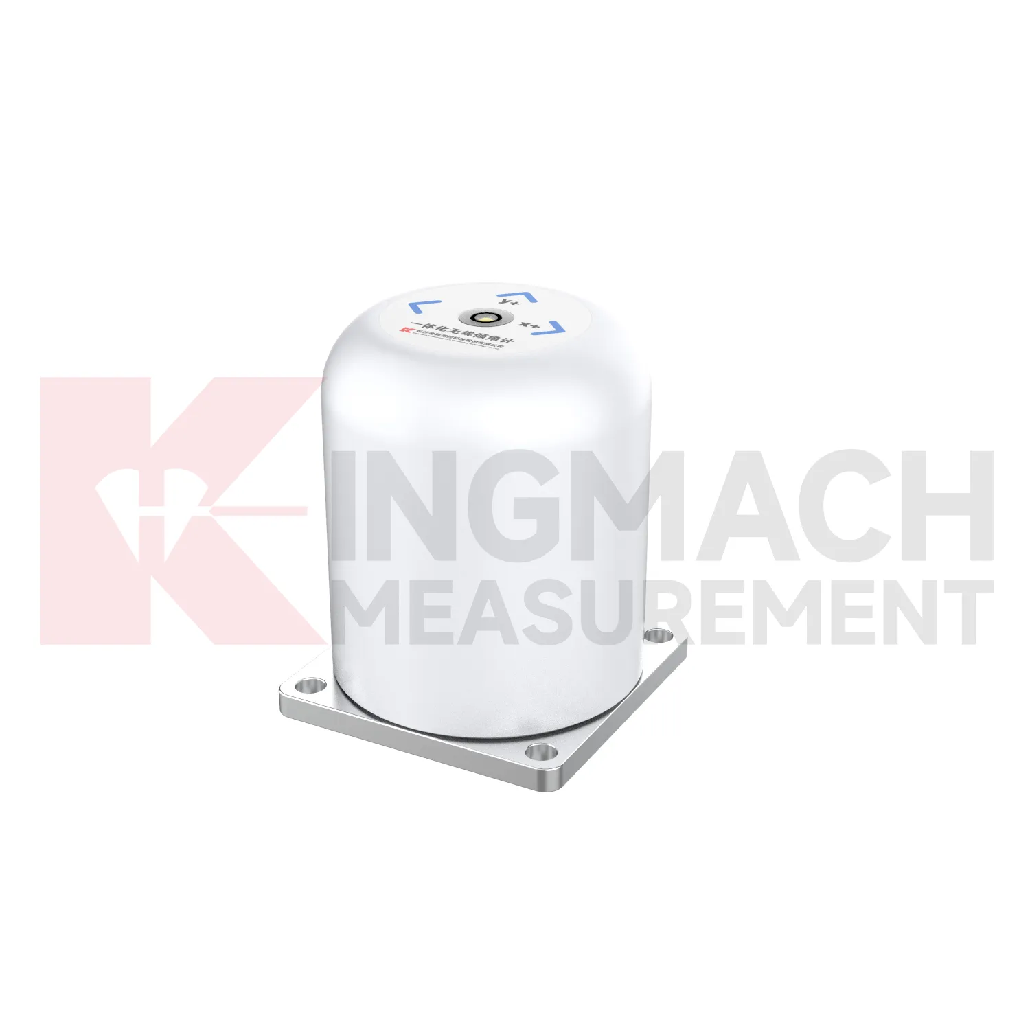
On busy construction sites, Kingmach Inclinometer must survive dust, moisture, vibration, cable handling, and limited access. Product pages describe sealed waterproof and dustproof designs, MEMS sensing, differential measurement principles, and low-power operation for selected systems. JMQJ-7315ADS lists IP68 protection, DC 9V to 24V supply, RS485 output, and an operating environment from -30 degrees Celsius to +80 degrees Celsius. JMQJ-7315RTU adds 4G wireless output and a 3.6V 38AH battery for remote work. These details matter because tilt monitoring often runs after excavation, filling, traffic opening, or structural operation begins. Installation teams should protect mounting surfaces, cable entries, enclosure seals, and axis markings. A durable field setup keeps the tilt curve meaningful instead of turning every storm or cabinet fault into a data question.
FAQ
Q: How accurate is the JMQJ-7315ADS tiltmeter?
A: The product page lists 0.001 degree resolution and 0.01 degree accuracy for the +/-15 degree dual-axis model.Q: What protection grade does JMQJ-7315ADS have?
A: It is listed with IP68 waterproof protection and an operating environment from -30 degrees Celsius to +80 degrees Celsius.Q: What range does JMQJ-7315RTU provide?
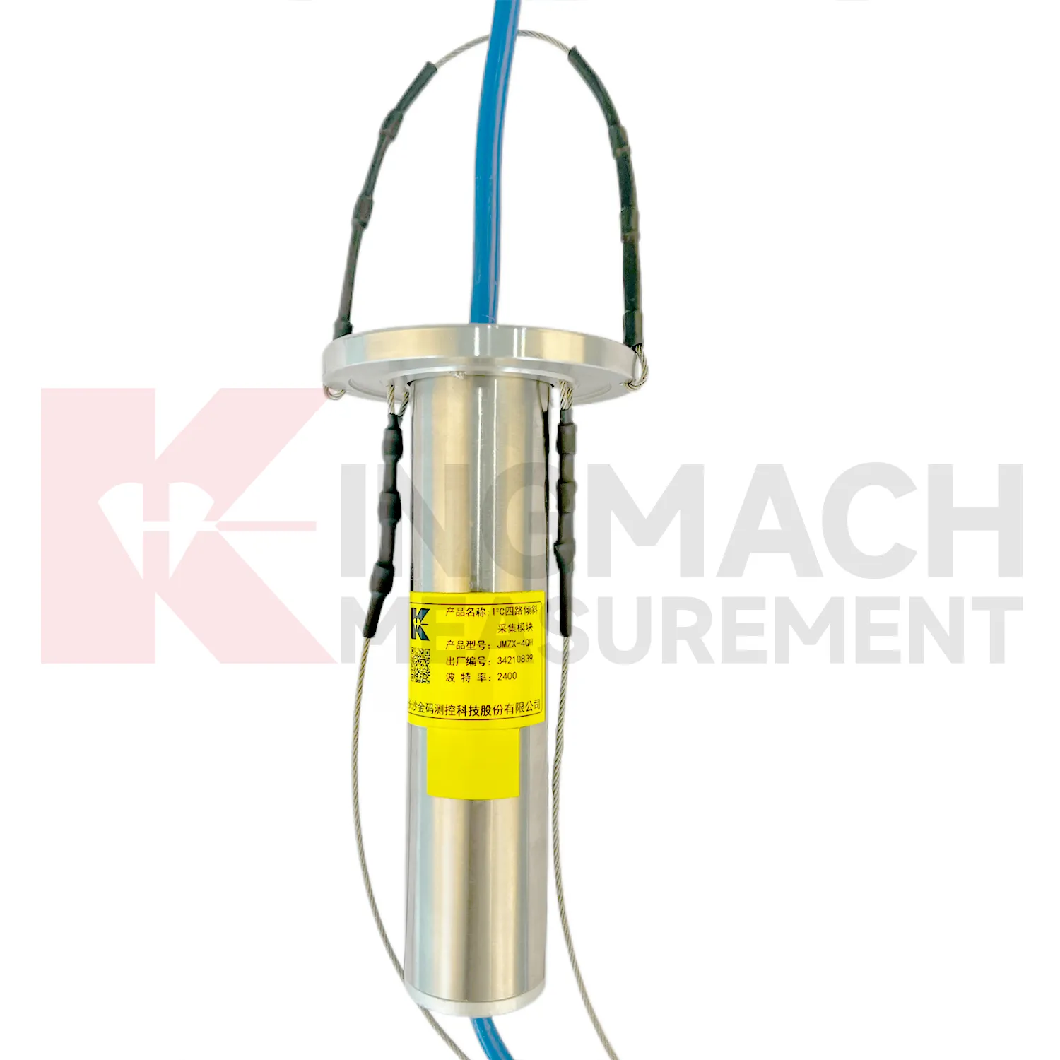
A: The integrated wireless model lists +/-30 degree and +/-15 degree dual-axis range options, with 0.001 resolution.Q: How many sensors can JMZX-4QH support?
A: The module lists four channels and support for up to 100 sensors in a multi-point inclinometer system.Q: What is the guide wheel spacing for JMZX-7100L?
A: The sliding inclinometer page lists a 500 mm guide wheel spacing reference and a +/-90 degree sensor range.
Reviews
Christopher Martinez
Very satisfied with the readouts & data loggers. User-friendly interface and supports multiple sensor inputs.
Michael Anderson
The strain gauges and load cells are extremely accurate and stable. They performed very well in our bridge monitoring project. Highly recommended!
Latest Inquiries
To protect the privacy of our buyers, only public service email domains like Gmail, Yahoo, and MSN will be displayed. Additionally, only a limited portion of the inquiry content will be shown.
Harper***@gmail.comIndia
Dear Sir, we are planning to procure a complete monitoring system including strain gauges, tiltmeter...
Isabella***@gmail.comGermany
Hello, we are evaluating weir flow meters for a water management project. Please share accuracy deta...